AllTrails Augmented Reality Redesign
Context
AllTrails provides the largest collection of trail maps with over 50,000+ trails in their database. Currently, users may use AllTrails to discover new trails, receive directions to the trail, and save favorite trails.
Objective
- Increase user engagement: Currently the AllTrails experience ends when users' hike begins. We wanted add a feature that would enhance their experience continuously.
- Create easy-to-use directions while hiking.
Challenge
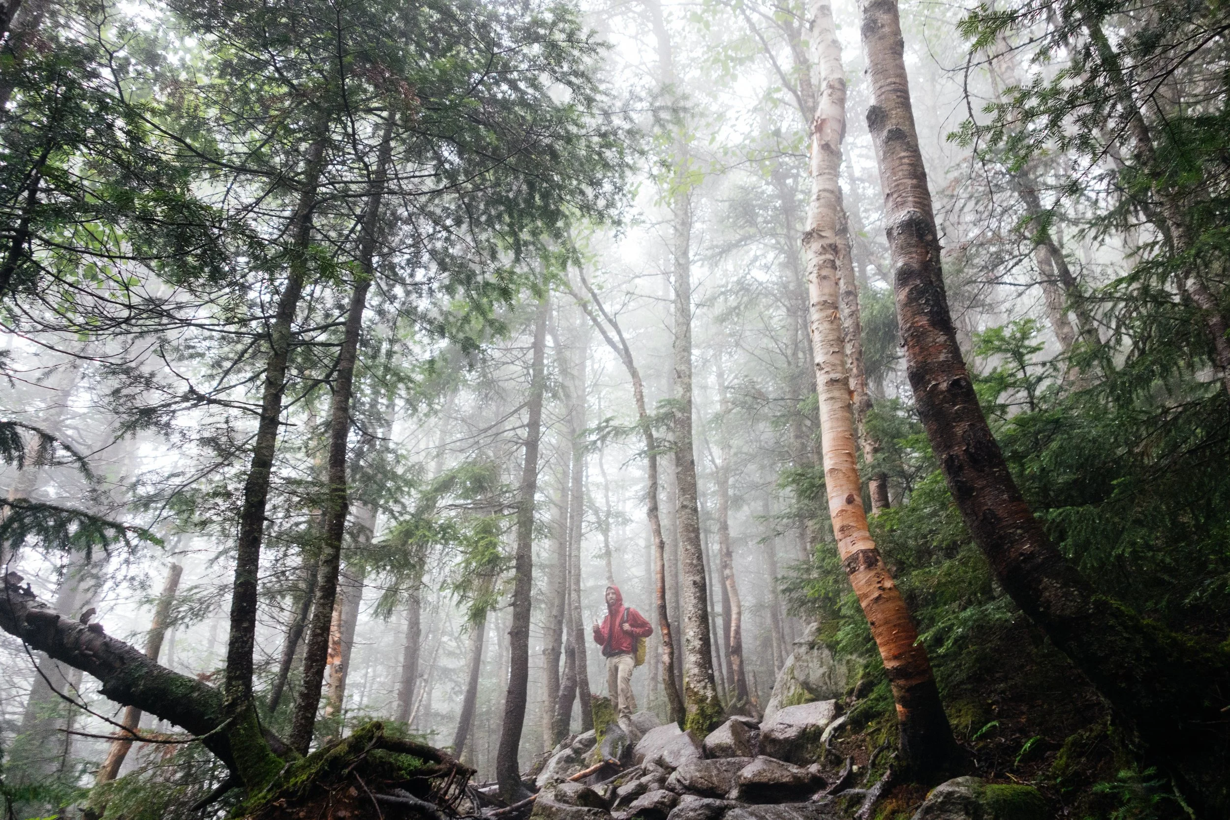
- Look up!: Provide directions that would not detract from the hikers' experience. From interviews, we knew that many hikers were wary of using technology on the trail. Survey showed that 52% of 82 respondents noted scenery as their main deciding factor for hiking.
Feature prioritization for users
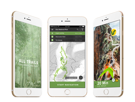
Main feature incorporated into the redesign of AllTrails. Through a round of 6 interviews, we realized that hikers unanimously experience at least one event of getting lost. When asked about their current solutions, users had no clear answer besides backtracking their route or using a map and compass if they had access to them. In fact, even advanced hikers had to use complicated navigational devices to navigate themselves through the trails. By using augmented reality, users of all levels can easily access directions, while experiencing the immersive experience of being in nature.
Augmented Reality GPS
Apps such as Mountain Project contain useful tips and tricks provided by their own tight-knit community of hikers and climbers. However, their busy interface made it difficult for users to weed through for useful and relevant information. Instead, we wanted to provide helpful live updates in real-time as a user is approaching specific areas.
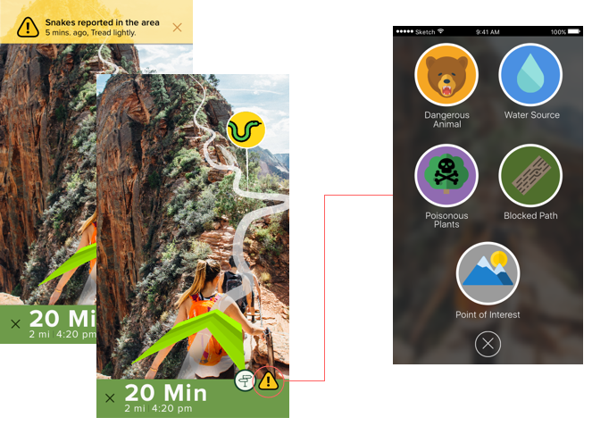
Crowd-sourcing & Live Updates
With over 50,000 trails in their database, users who used AllTrails currently were very optimistic about the potential for trail discovery. However, when we performed user testing on 5 new participants, we discovered that filtering for specific trails of their needs was quite difficult for users. We wanted to simplify the search and filter process with features needed by users. We narrowed down the most important filter features through interviews, surveys, and user testing.
Filtering in Search
Favorites & Recommended
During interviews, we found out that users desired recommended hikes that they could discover based on their favorited hikes and past hikes. We wanted to create a discovery process that required little effort of the users.
To increase user engagement even further, we wanted to incorporate gamification to the AllTrails app. With the popularity of Pokemon Go, the profile page, which tracks user's level and their earned badges, were well received during user testing.
Gamification
Final Mockups
Testing and Re-iterating
GPS/Navigation

- After user testing with 5 participants, we decided to narrow the color palette to solely green and grey on the Navigation Search Page. Red was misconstrued as being "dangerous" or "unreachable" routes.
- Users were not aware that they could begin navigation by pressing the dropped pin. We changed to a simple "start navigation" to clear any ambiguities.
- Users were overwhelmed by the number of buttons in the original navigation page. In order simplify the interface, we changed to a hamburger menu.
Augmented Reality Directions

- Users could not access buttons when on the top left corner. Additionally, they were confused about the actual functions of the button. We brought the two buttons to an accessible bottom right and changed the colors and shapes to signify "trail info" and "alerts."
Before and After Redesigns
Filter

- Users felt overwhelmed by the choices with previous filter page. We condensed the filter to easy to choose buttons and narrowed down/prioritized the choices based on research
Trail Pictures

"Sometimes I never know what to expect because the trail pictures aren't up to date" - Jason.
Instead of thousands of crowdsourced photos on the trail page, we opted for only current, high-quality photos of the trail, divided into all four seasons, to better gauge the users' on what to expect.
Added Features
Crowdsourcing & Live Updates
My Trails

- While hiking, users can now view their position in an overview map, hourly weather updates, and altitude in relation to their current location.
Recommended Discovery

- Search Page also features recommended hikes curated for each individual hiker based on previously finished hikes and favorited trails.
